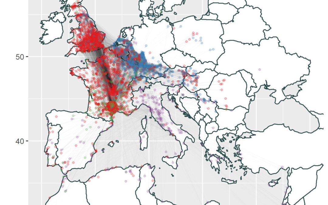
ABSTRACT: This work concerns the analysis of data related to Terra Sigillata (TS), gathered integrating different sources, and carried out within the ArchAIDE project (www.archaide.eu). We analysed the data to disclose statistical relationships between the variables considered. Statistical techniques were used as explorative in order to summarise main characteristics of data and identify outliers, trends or patterns. Specifically, we focused on Network Analysis and on the identification of significant temporal breaks in the data. The network structure is given by linking together locations where ceramics were produced to locations where the same ceramics were retrieved, getting 3853 locations forming its vertices, throughout Europe, Middle East and North Africa. The 16820 different edges were built joining 322764 different data. Network analysis allowed identifying communities in the network, i.e. groups of vertices being densely connected internally but poorly connected externally. Such communities can represent commercial routes adopted by producers, or that established themselves by geographical or historical reasons. Temporal breaks were identified by an algorithm minimising the variance within intervals, while maximising the variance between intervals.
Production and supply of ceramics have a specific relevance only in certain temporal intervals. We were able to distinguish four main periods, characterised by different production centres emerging and declining in the different phases (Italian, South-Gaulish, Rhine productions), and showing different production dynamics. This work also underlines how the availability of high volume of data (unfortunately rare in Archaeology), joined with data analysis, allows new insight into archaeological research.
In ArcheoLogica Data 1/2021, open access journal, you can find “Spatio-temporal network analysis applied to Roman Terra Sigillata” by Gabriele Gattiglia & Nevio Dubbini (https://www.mappalab.eu/wp-content/uploads/2021/06/05_spatioTemporalAnalysis.pdf). Linked dataset with stamps of #terrasigillata in .csv format is available as open data in MAPPA Open Data Archive (http://mappaproject.arch.unipi.it/mod/Archive.php?t=i&pk=609d0920115b22.97037035).


